CONTOUR MAPPING / DEM / LiDAR
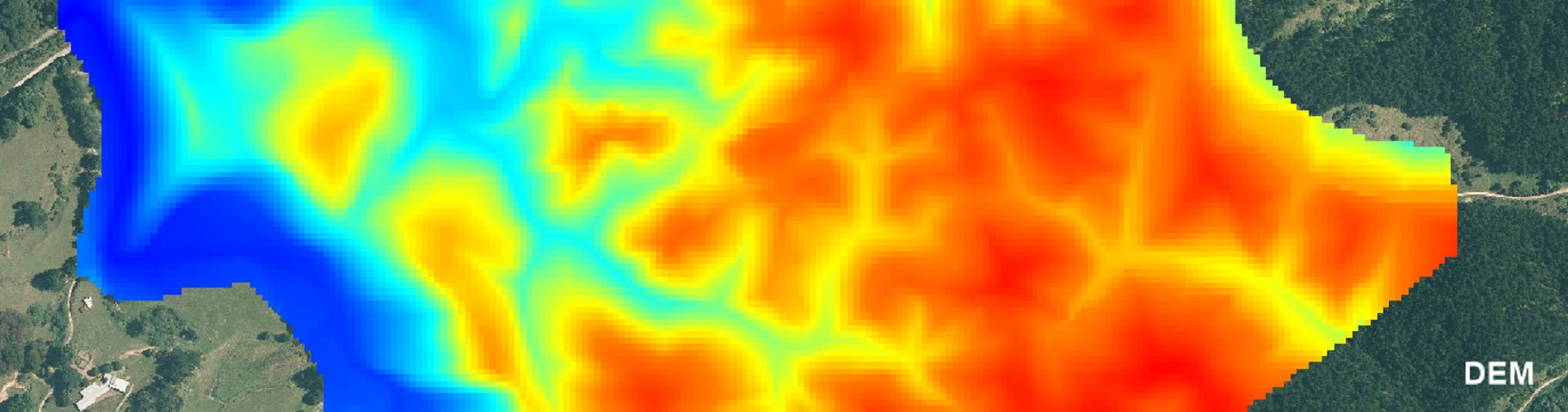
As an alternative to LiDar survey ( Light Detection and Ranging ) , of which, many remote parts of NZ are yet to be covered, MAPS can generate cost effective DEM's ( Digital Elevation models ) using digital photogrammetry, from overlapping Aerial Photography.
We have access to a large library of historical imagery in NZ from which can be used in generating these DEMs.
A big advantage from using historical images is that the DEMs can capture bare ground profiles before afforestation, which assists in more accurate Harvest planning.
Also it is an advantage to view the history of a block for track locations.
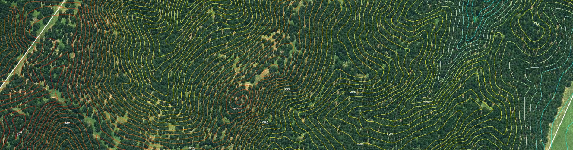
From the DEMs we can produce contour intervals suited to the clients requirements according to the scale limitations of the photography.
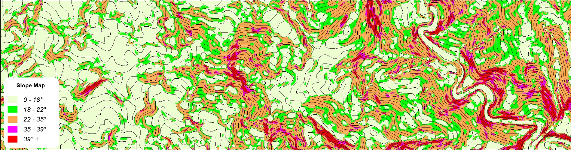
Relief and Slope Maps can be also be derived from the DEM's.
LiDar data from any supplier can be manipulated to supply contours or DEMs.