logo
  • Email

    forestrymaps@gmail.com

  • Phone

    06 222 3470

  • Postal Address

    PO Box 75, Palmerston North, New Zealand

Forest Mapping / Data Analysis

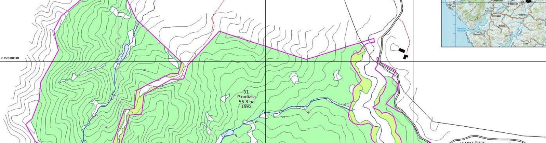
MAPS specialises in Forestry mapping. This involves detailed mapping from Aerial Photography, whether it is sourced from us or outside companies. We have a comprehensive library of photography and maps of Forestry Blocks throughout the country.

MAPS works with many Forest Owners, Managers, Consultants, Valuers, and Insurance Assessors throughout NZ to provide accurate area information for a host of purposes.

Our experiences of detailed mapping include:

  • Accurate areas for contractor payments. (No conflict of Interest ).
  • Stand Windthrow / Fire damage for Insurance payouts ( No conflict of Interest )
  • Wind Farm Resource Consent mapping
  • Maps for planning new development, roading, harvesting and silvicultural operations
  • Plot locations
  • Pest and disease control
  • Recreation
  • Search and Rescue
  • Valuations
  • Due Dilligence for new acquisitions. Net Stocked Area mapping or sampling
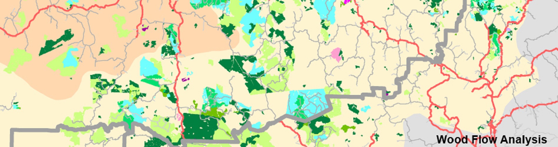
  • Wood flow Analysis Mapping at a Regional or National Scale. ie Age classes, distances from Mills / Ports

CONTACT US HERE

Mail US Call US
single-project-img-1

Our experience is a long and dedicated affiliation with the Forest industry. We are very conversant with accepted and proven mapping methods, as well as being aware of and putting to use new digital technology now available. All mapping can be GIS ready for most GIS desktop systems available today.

In this digital age, maps can easily be made to suit your requirements with the use of colour and an unlimited number of ways of displaying graphical detail.

By using and being supported by one the most well known desktop mapping software packages in the world, MAPS can input its digital data to any GPS related service available now and well into the future.

Any photograph, map or map product produced at MAPS can be presented electronically to be printed anywhere in the world.

From contour mapping with stereo photography to getting accurate measurements for contractor payments, give MAPS a call on 06 222 3470, or email your enquiry to forestrymaps@gmail.com

One of the team will be happy to help you plan the best product for you.